OCEAN MAPPING EQUIPMENT
OCEAN MAPPING EQUIPMENT
HOME >TECHNOLOGY>OCEAN MAPPING EQUIPMENT


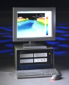
GeoSwath is a PC based, shallow water, wide swath bathymetry system. It has been designed to produce an accurate digital terrain map (DTM) of a survey area or route in water depths up to 200 meters. GeoSwath offers wide swath coverage of up to 12 times water depth, to a maximum swath width of 600 meters. GeoAcoustics can offer a complete range of commended sensors for tide, sound velocity, heading, position and attitude, all of which can interface directly with GeoSwath. All data acquisition, real time processing, post processing, and chart generation can be accomplished on the same GeoSwath unit.
Specification:
l Sonar Frequency: 125kHz
l Maximum Water Depth: 200 m
l Maximum swath Width: 600 m
l Range up to 12 x depth
l Resolution Across Track: 1.5 cm
l Two Way Beam Width: 0.9° Azimuth
l Swath Update Rate: 10 swaths per second (150m Swath Width)
5 swaths per second (300m Swath Width)
2.5 swaths per second (600m swath width)

© 2010 All Rights Reserved Tianjin Raven Enterprise Management
Add:NO.5369XinbeiRoad,Tanggu Tianjin,P.R.China TEL:022-25212800
Consulting Services Limited 津 ICP 备: 11003650
FAX:25213110 E-mail:cthme@cthme.com.cn

