

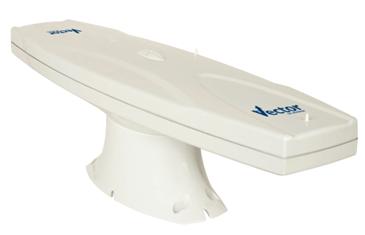
VECTOR difference direction receiver is the set of GPS differential positioning and attitude measurement , it uses the base station of mobile RTK technology complex, and It can make two multipath suppression antenna work together, And then can get the position / orientation High-precision results. GPS compass its built-in provides precise range and reliable location information for your navigation system.
Marine surveying
Waterway Dredging Engineering
Construction of navigation and marine engineering
Pipe cable laying
Technical indicators
The performance index
Receiver type: L1, C/A codes with carrier phase smoothing
The number of channels: 12 channel parallel tracking
Range data update rate: the maximum 10Hz
Location update rate: the maximum 5Hz
Horizontal positional accuracy: <1 m 95% (DGPS)
Range data accuracy: 1 ° RMS
Position locking <20 seconds
Satellite recapture < 1
Communication parameters
Serial port: 2 full duplex RS232 interface, 1 RS422 interfaces
Baud rate: 4800, 9600, 19200 BPS
The I/O protocol: NMEA0183 and SLX binary
Correction of I/O protocol: RTCM SC-104
Timing output: 1PPS (HCMOS)
NMEA position statement: $HEHDT, $HEROT
Environmental parameters
Operating temperature: -30 ℃ ~ +70 ℃
Storage temperature: -40 ℃ ~ +85 ℃
Humidity: 95% no condensation
Physical indicators
Size: 60cm x 16cm x 18cm
Weight: <1.5KG
