

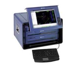
Ranger2 Ultra short baseline positioning system( USBL)
Since the beginning of the new century,With China's increasing emphasis on the marine rights and interests, The development of marine resources has in-depth. Highprecision underwater
positioning system is widely used in Marine resources exploration,marine surveying and mapping, The construction of buildings under water, Underwater divers. While the Ranger 2 USBL navigation
positioning system for the work can provide continuous, stable, high precision data. There is a broad application prospect.
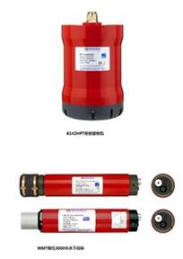
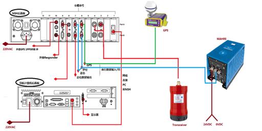
Ranger 2 USBL system is mainly composed of a hydrophone,navigation control host, and beacon.
System characteristics:
The maximum water depth: 7000 meters
The ranging accuracy: 6mm (theory)
System compatibility: analog beacon HPR, WSM, C5 , C6,WMT beacon;
Maximum power: 15W (standby), 100W (peak)
Slant range accuracy: ± 2.75% (the built-in compass andinclinometer)
± 0.05% (external high precision compass and attitude sensor)
Operating temperature: -5 ℃ ~ 30 ℃
The storage temperature: -20 ℃ ~ 70 ℃
Hydrophone:
Specification: 225mm diameter x 370mm Length
Weight: 22kg In the air and 11kg In the water
Range: 500Meters
