

 |
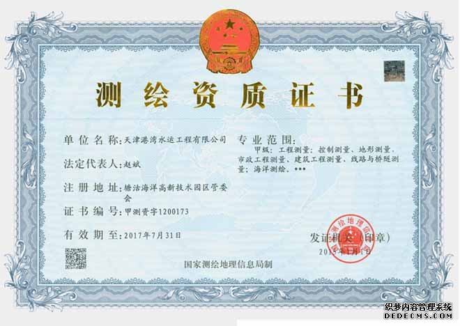
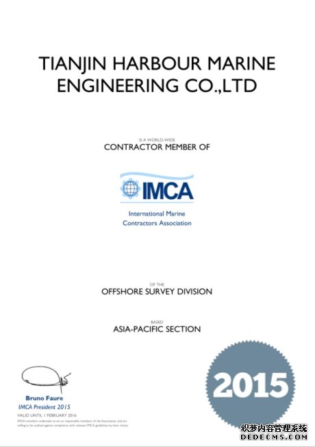
Tianjin Harbour Marine Engineering Co., Ltd. (Hereinafter called CTHME for short), founded in 2000, is engaging in offshore surveying & mapping and engineering surveying, and has obtained two “first grade” certificate of surveying & mapping and engineering surveying qualification issued by Scientific Bureau for Surveying and Mapping (SBMS) of The people’s Republic of China. CTHME is also a member of IMCA that is a international maritime contractors association. Over the years, CTHME based on the technology personnel, and employed many excellent talents. Until now, CTHME has 121 employees, therein 103 persons of survey technique personnels (including 8 persons of high degree title, 17 personnel of middling degree title), and 2 persons of international Hydrographic A grade Surveying Engineering, and 5 persons of registered surveyor. |
|
Since company was founded, CTHME continuously expand the surveying market, and has purchased a lot of high precision instruments, including Trimble DGPS system, GPS Vector system, middle distance reference station of NDS200 MR2, Sagitta-01DGPS system(DGPS mobile station), USBL Underwater Positioning System, GyroUSBL Underwater Positioning System, LBL Underwater Positioning System, Geopulse high precision Subbottom Profiler/pipeline profiler, real-time mosaic side scan sonar, offshore magnetometer, multi-beam bathymetric system, double frequency/single-beam Echo Sounder, Gyro-compass, computer, Total Station, balance Level, middle distance ranging, current meter, HP520 plotting instrument,etc.
With continuous efforts, CTHME is capable of undertaking various surveying project, including navigation and positioning of barge, navigation and positioning of offshore construction, navigation and positioning and inspection of underwater target, sub-sea survey, hydrographic survey, geodesy, topography surveying, engineering survey and cadastral survey. |
|
|
|
|
  |
|
